|
|
|
The information on this page comes from the writing or Erick Brenstrum, who has over twenty years' experience of forecasting the weather.
|
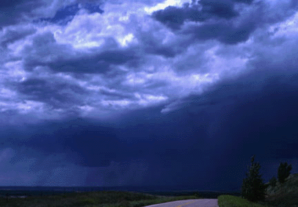
When we see a large anticyclone on a weather map, most of us think of sunny days and light winds. In fact, anticyclones often have a full hat of tricks, including overcast skies, drizzle, thunderstorms, flash floods and even gales. Thunderstorms are a risk in anticyclones during the summer half of the year. They can form in the afternoon over inland areas where the surface temperatures are highest, such as stony hillsides. Air from over the ocean has lots of water vapour. Once this air is pulled into the strong updraughts inside a thunderstorm cloud, most of the water vapour condenses to liquid. As it does so, heat is released, which increases the buoyancy of the air and maintains or even accelerates its upward motion. Aside from low cloud and drizzle, another characteristic of anticyclones in winter is fog. Anticyclones are responsible for much of our fine weather, but the longer they are nearby, the greater the risk that something may go wrong. |
 |