|
|
|
 |
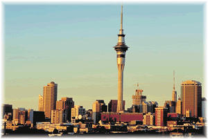
Imagine there was a volcanic eruption in Auckland.... it might go like this...
|
|
|
|
Imagine there was a volcanic eruption in Auckland.... it might go like this...
Day 1: An Earthquake is felt weakly occurring in the Auckland Area. It just feels like a heavy truck rumbling past.
Day 6: Throughout the next few days more tremors are felt, but they are thought to be aftershocks.
Day 10: More earthquakes take place, lightly felt in Auckland. Scientists put out seismographs to measure what is happening.
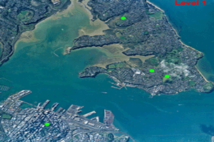
Day 19: 25 earthquakes are recorded in one day. They are getting closer to the surface, and Civil Defence say there is a threat of volcanic eruption and announce a Level 2 Alert.
Day 22: 150 earthquakes felt by people in Devonport and the CBD. Some minor damage occurs to buildings - plaster cracks, items falling off shelves.
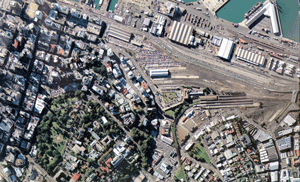
Day 23: Earthquakes continue. Tilt-level measuring sites at the Container Wharf indicate that some uplifting of the land may be taking place.
Day 24: Not so many earthquakes. Longer periods between tremors. No change to the land around the Container Wharf.
Day 25: A dramatic increase in earthquakes. Over 200 are felt as minor shaking in buildings in the CBD and Devonport. Volcanic tremors are now almost continuous. Sulphurous gas is smelt at Mechanics Bay. Level 3 Alert is declared. There is now a real danger of a hazardous volcanic eruption taking place. Earthquakes continue during the night.
Day 26: The Day of the Eruption
4:00am:
Seismic activity peaks; continuous volcanic tremors; shaking damage to buildings in CBD and Wharf. Ground cracking in the Railway-Container Wharf area.
6:00am:
Ground shaking gets worse; severe damage to buildings; ground cracks widen; buildings and structures near them collapse. Steam appears from vents near cracks; volcanic gas emitted; strong smell of sulphur dioxide. The wind takes gas plume towards Devonport
8:00am:
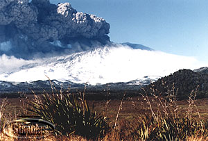
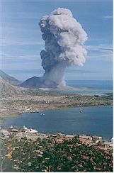
Small eruptions throw volcanic material into the air. Violent eruptions take place along a 300 metre long fissure. Large earthquakes and large jetting eruptions. Some large windows are broken up to 2 km away. The column of erupted material is now 3 kilometre high. Level 4 Alert is declared. A dangerous local eruption is taking place. A large scale eruption is now possible.
8:40am:
More frequent and larger explosions take place. Eruption column rises to 8km. Eruption fissure extends into the sea. Continues to expand. Surges of rock material and basaltic magma spread across low lying areas. Rocks 2m in size fall on buildings and start fires. Frequent lightning pulses are seen in the volcanic column.
9:00am:
Explosions and eruptions intensify. Base surges flow into Parnell and CBD and into the Harbour. Surges destroy the Mechanics Bay area. The area is filled with magma and flowing material. Strongly constructed buildings remain standing but are damaged by sand blasting and are partly buried. There are heavy tephra falls in Devonport. Large waves hit the beaches on the North Shore. A Level 5 Alert is declared, a large Hazardous eruption is in progress.
1:00pm:
Scoria and ash has fallen as far away as Newmarket, Remuera and Ellerslie and Mt Wellington. Northcote and Takapuna are also covered with ash.
The eruption cloud has risen to 10 km. Eruptions continue during the night. Flat areas in Parnell and Albert Park is completely buried in tuff.
During the next 3 months the eruptions continue. Roads are blocked. More buildings collapse from shaking and tephra falls. Fire fountains occur. Scoria and ash is carried by the changing winds. Lava flows out to the Naval Base. The channel becomes blocked. Lava continues to flow forming a similar volcanic structure to Rangitoto. The previous Waitemata Harbour is now a lake dammed behind the lava wall. A plan is made to cut a new channel through the Takapuna area.