Activity T10: Weather Prediction

Tiritiri Matangi Activity

Small map of Tiritiri Matangi - Click for LEARNZ Tiritiri Matangi homepage. Image: Heurisko Ltd

Teacher Manual P 32

Science Level 4

Making Sense of Planet Earth and Beyond

Created 21/09/2001

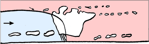
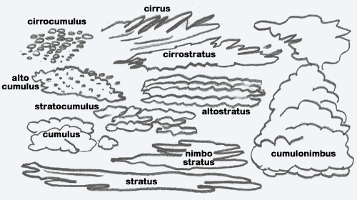
AO1 - Students can investigate major factors and patterns associated with weather, and use given data to predict weather.

SLO - Students will be able to find out about weather recording and forecasting on Tiritiri Matangi. They can observe weather locally and make their own weather predictions.

Read Hauraki Weather and Weather Recording.

  1. Tiritiri Matangi's location in the Hauraki Gulf means that it is subjected to winds from all directions.

    1. What is Tiritiri Matangi's prevailing wind?


    2. Is this wind warm or cold?


    3. Use the terms in the table to label the following diagram to show what happens when this meets the warm Pacific Ocean air.

      cold front     cold air     cumulus     cumulonimbus     cirrus     altostratus     warm air


      Diagram of cold front - Image: Heurisko Ltd

  2. Name the equipment DoC ranger Ray Walter uses to measure weather features on Tiritiri Matangi.


  3. Clouds have different names depending on their type. Study the sketches below.

    Labelled diagram showing different clouds - Image: Heurisko Ltd

    1. Use the correct cloud names to describe the clouds you can see in the sky as you look out the window.


    2. If the meaning of nimbus means rain cloud, make a prediction about the weather for tomorrow from today's cloud observations.


Great Barrier Island | Tiritiri Matangi

© Heurisko Ltd www.learnz.org.nz/2001