|
|
|
|
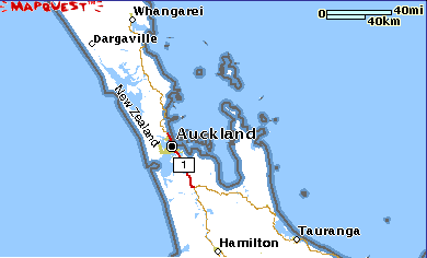
Maps can show little detail if they show a huge area, and lots of detail (like a street map) if they only show a small area. Measuring distance on a map is done with a map scale. Since a map is basically a drawing of a place, it is much, much smaller than that actual place. In order to know how far distances on a map are equal to on the ground, it is necessary to use a map scale. The map scale shows for example, how many kilometres a centimetre is equal to on a map.
|
|
For example, this map shows where Auckland is relative to other main towns in the North Island of New Zealand. |
|
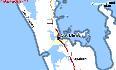
This is a closer view, showing main roads only. Look at the scale - it shows you that a centimetre on the map is just over 10km in real terms. |
|
|
|
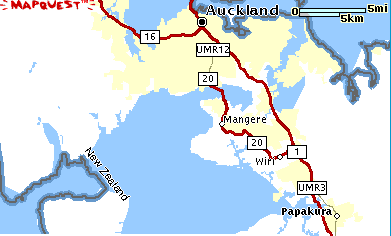
Now you can see more clearly how the coastline is formed, and suburbs of Auckland. |
|
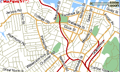
Look at the difference in scale between this map and the second one. You can now see the roads (although only the main ones are named). There is a lot more detail, but it is showing a much smaller area. |
|