|
|
|
|
Political Maps:
Political maps are maps that have to do
with government. They show where the boundaries and locations of
countries, states, cities, towns and counties are. These boundaries
and locations are generally determined by people rather than nature.
This is a political map below.

Countries are parts of continents with their own central government, sometimes referred to as nations.
Counties are the parts in which a state is divided for purposes of government. The county seat is the city or town in which the governing of the county takes place.
Cities are the parts of states or counties with great numbers of people living and/or working there.
Towns are like cities, but are smaller with fewer people.
Physical Maps:
Physical or Elevation or
Topographic/Relief Maps show how high or low places are, generally in
relation to sea level. They are of value not only for this, but also
to help determine the climate of an area. Below is a shaded relief
map of New Zealand and Australia. There are several important terms
that relate to these kinds of maps:
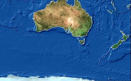
These kinds of maps tend show mountains, and rivers and other physical features, so they do not show as many towns and cities.
Weather
Maps:
Weather maps are maps that show
predictions of coming weather or report on weather that is actually
happening. Weather is how hot or cold or how wet or dry it is in a
location over a short period of time.
There are a number of factors that affect
weather. These factors are similar to those that affect
climate. They are: * How far a place is from the
equator. * How high a place is above sea
level * Which side of a mountain a place is
located * If a place is inland or near
water A weather map will show the viewer on the
map and in the map key and legend: * The high and low
temperatures * Cloud cover in an area * The precipitation - how much rain,
snow, other water forms that fall from the sky * The wind speed, wind direction and wind
chill (the temperature with the wind factored in) * The humidity of an area - how much
water vapor is in the air or how damp it is * Oncoming weather conditions
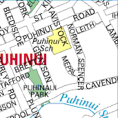
Road
Maps: Road maps show you the streets with their
names, so that drivers can find their way when they are
driving round a part of a city that they do not know
well.
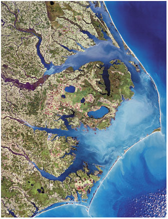
Aerial
Maps: An aerial map is made up from a lot of
photographs taken from a plane, or sometimes from a
satellite. It is a good way of seeing a coastline,
such as that shown to the right, and rivers and
lakes. Can you see areas of open land, and where
there are houses?
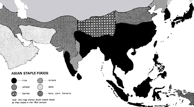
Historical Maps:
Historical maps show things that happened
a long time ago, in the past.
For example, this map shows the staple foods people in Asia ate 600 years ago.
Down the bottom is the key, which explains what
the different patterns on the map mean. In a physical map, different
colours are often used to show how high the ground is above sea
level. The key will show what the different colours mean.
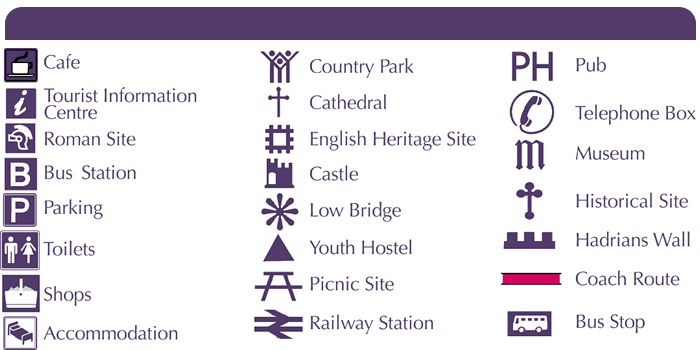
For people to be able to understand the
symbols used on a map, you use a key, like the one on the
right, to explain what they mean. People looking at the map will see a
triangle, and they know it will mean there is a Youth Hostel
at that place. Or if they see a P, they know it means a
parking area. Now that you have read all of this, try
yourself out on the
mapping quiz!