|
|
|
|
Auckland is built on a narrow bit of
land between two coasts. The Tasman Sea is to the west, and
the Pacific Ocean is to the east. To the west, the Manukau
Harbour flows into the Tasman Sea, while the Waitemata
Harbour opens into the Hauraki Gulf on the east, and then
out into the Pacific.The Harbour Bridge crosses the
Waitemata to get from the city to the North Shore. The
Hauraki Gulf is beautifully dotted with sailboats and
contains many islands. The city is built over an ancient
volcanic field, with over 40 volcanic vents and seven small
but extinct volcanoes. Auckland's highest natural feature,
Mount Eden, stands 196 metres in height and provides good
views of the city and harbour. Maori people are first thought to
have settled in the Auckland region approximately 650 years
ago because of its rich and fertile land. The name given by
the early Maori for the area, 'Tamaki', means 'battle',
because there was a lot of fighting over this valuable
land. The volcanic cones that are dotted
all over Auckland became natural sites for pas, or fortified
Maori settlements. You can still see the remains of the
earth works for these pas on Mount Eden and One Tree Hill.
By 1840 the British had either beaten
or bought out (generally for a few trinkets) the Ngati
Whatua tribe. New Zealand's first governor, Captain William
Hobson, chose Auckland as the capital. Hobson decided upon the name
Auckland, in honour of his patron and former commander, Lord
Auckland (at that time, the viceroy of India). Lord
Auckland's family name was Eden, and a great many parts of
the city bear this name also.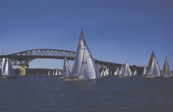
Back to
Top